Observing National Parks From Space
Imagine exploring the vast beauty of national parks, not by hiking trails or scenic drives, but from the boundless perspective of space. Thanks to advancements in satellite technology, the landscapes that have captivated millions on the ground can now be observed from above, offering a stunning new way to appreciate the Earth’s natural wonders. This article will guide you through online tools that offer historical and current satellite imagery of national parks, revealing hidden patterns, geographic details, and a fresh perspective on the ecosystems that make these places so remarkable.
The Power of Satellite Imagery
Remote sensing has revolutionized how we see and understand the world, offering insights far beyond what is possible from the ground. Especially when looking for current satellite imagery has become easier than ever before. Modern satellites provide us with detailed views of the Earth’s surface, capturing everything from bustling cities to remote wilderness. But the true power of satellite imagery lies in its ability to reveal patterns, changes, and trends that would otherwise go unnoticed. From tracking urban expansion to monitoring natural disasters, satellites give us a real-time understanding of how our planet is evolving, empowering scientists, policymakers, and environmentalists to make informed decisions.
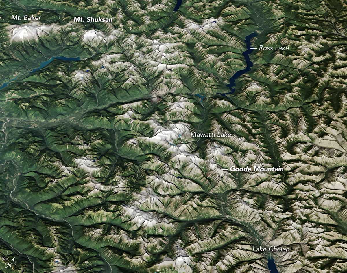
When it comes to national parks, satellite imagery plays a crucial role in monitoring these protected landscapes. From space, we can track environmental changes such as deforestation, erosion, and even the effects of climate change on delicate ecosystems. It allows park officials to spot illegal activities, like poaching or unauthorized development, and take action before significant damage is done. Satellite pictures also offer a unique way to showcase the breathtaking beauty of these parks, providing a bird’s-eye view of the landscapes that have been preserved for generations. With up-to-date satellite images, we now have the tools to protect and appreciate national parks like never before, ensuring they remain pristine for future generations. Let’s go through the most used of them.
Google Earth
This powerful tool that brings the world to its users fingertips, allowing them to explore any corner of the globe with just a few clicks. Combining high-resolution satellite imagery with an intuitive interface, it offers a detailed, interactive map of the planet. From towering mountain ranges to bustling city streets, Google Earth makes it possible to explore these landscapes in stunning detail.
As for national parks, Google Earth plays a unique role in monitoring and preserving these natural treasures. Invested parties can access detailed satellite views of national parks to track environmental changes, analyze terrain, spot unauthorized activities, or simply appreciate their vast beauty. With this tool, anyone can explore the wonders of protected areas around the world, gaining a fresh perspective on the importance of preserving these irreplaceable ecosystems.
NASA Worldview
NASA’s Worldview platform offers a powerful way to explore most recent satellite images from multiple sources, giving users the ability to view national parks from space with near real-time updates. This tool is particularly valuable for monitoring environmental changes within these protected areas, such as wildfires, floods, or deforestation. By keeping a close watch on these shifts, Worldview helps park officials and researchers respond to potential threats swiftly and efficiently.
One of the standout features of NASA Worldview is its customizable satellite layers, allowing users to focus on specific data like land cover, vegetation health, or atmospheric conditions. This flexibility offers a deeper insight into how environmental factors are affecting national parks, making it an essential tool for understanding and protecting these natural wonders.
Sentinel Hub
Sentinel Hub is an advanced platform that simplifies access to satellite data from the European Space Agency’s Copernicus program, particularly the Sentinel satellites. With its user-friendly interface, it allows individuals, businesses, and institutions to access and process vast amounts of Earth observation data without needing deep technical expertise. This makes it a powerful tool for environmental monitoring, agriculture, urban planning, and disaster management.
Sentinel Hub provides a powerful way to access satellite imagery across multiple spectrums, offering insights into various aspects of the environment such as plant health, water sources, and soil quality. It allows users to observe national parks with remarkable detail, tracking their evolution over time. The platform’s time-lapse capabilities make it possible to study seasonal shifts and assess the impact of events like wildfires or floods on these protected areas.
EOSDA LandViewer
EOSDA LandViewer is an advanced geospatial tool designed for easy access to satellite imagery and comprehensive geospatial data. With its user-friendly interface, it allows users to visualize, analyze, and interpret Earth observation data with ease. Whether it’s tracking environmental shifts, examining infrastructure growth, or observing land use, EOSDA LandViewer equips users with the necessary tools for making informed decisions based on real-time and historical satellite images.
For national park monitoring, EOSDA LandViewer offers immense value. Park authorities can utilize the platform to detect environmental changes over time, such as deforestation, habitat loss, or illegal land use. By comparing satellite images from different dates, park managers can pinpoint areas affected by human activity or natural disasters. The time-series analysis tool even allows for forecasting potential future changes, helping to prevent potential issues. Additionally, with high-resolution imagery and dynamic time-lapse animations, EOSDA LandViewer enables seamless tracking and communication of the park’s environmental health, aiding in conservation efforts.
Why View National Parks from Space
Experiencing national parks through satellite view of the Earth offers a whole new dimension of understanding. Let’s wrap up what the involved parties can do today using the above mentioned digital instruments:
- With satellite imagery, park officials and researchers can closely monitor the condition of ecosystems within national parks. This includes observing vegetation shifts, tracking water levels in bodies of water, and identifying threats such as illegal logging. These insights are crucial in protecting and preserving fragile environments.
- As the effects of climate change unfold, many national parks are facing significant transformations. From shrinking glaciers to shifting animal habitats, satellite imagery provides a way to follow these changes in real time, offering a clearer picture of how global warming is reshaping some of the planet’s most treasured places.
- Many national parks contain areas that are difficult or even impossible to reach due to rugged terrain or isolation. Satellites give us the ability to explore these remote regions, providing a comprehensive view of their untamed landscapes without the need for physical travel.
- Viewing parks from space is not just informative — it’s a unique educational tool. It helps people grasp the broader patterns of geography, environmental processes, and the importance of conservation. This kind of virtual exploration sparks curiosity and fosters a deeper connection to nature.
Whether you’re examining environmental shifts, watching the effects of climate change, or just enjoying a fresh view of nature’s most stunning landscapes, satellite technology opens up new possibilities. Through platforms like Sentinel Hub, NASA Worldview, EOSDA LandViewer, and others, we can gain an insightful and inspiring look at the world’s precious nature jewels, helping to promote conservation efforts and ensuring their legacy for future generations.
Autor:
Petro Kogut has a PhD in Physics and Mathematics and is the author of multiple scientific publications. Among other topics, he has a specific focus on a satellite imagery processing and application in his academic research. Currently, Prof. Dr. Petro Kogut also works a science advisor.
