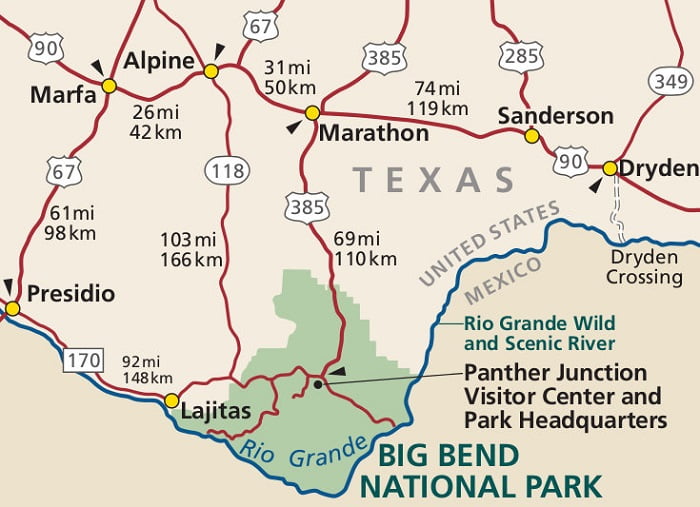
Big Bend National Park Map Guide
You also see Marathon, Texas map on this map
How to get to Big Bend National Park
The closest airports to Big Bend National Park are at Midland, Texas (Northeast 230 miles) and El Paso, Texas (Northwest 325 miles).
From the North
Take Highway 385 South to Marathon, Texas and then South to the North Entrance of Big Bend National Park.
From the East
Take Highway 385 South to Marathon, Texas and then South to the North Entrance of Big Bend National Park.
From the West
1. Take I-10 East to Van Horn, Texas. At Van Horn then take Highway 90 South to Marfa and Alpine, Texas then take State Route 118 South from Alpine, Texas to the West Entrance of the park.
2. Take Ranch Road 170 from Presidio, Texas to Study Butte, Texas and then State Route 118 to the West Entrance.
Big Bend National Park headquarters is located at Panther Junction, 70 miles south of Marathon, Texas via Highway 385 and 108 miles from Alpine, Texas via Highway 118.

